Wednesday, June 29, 2011

0036 – Geophysics at Monte do Olival 1


A first glimpse into the results obtained by the NIA-ERA project directed by me and with Helmut Becker responsible for the geophysics.

Tuesday, June 28, 2011

0035 – Porto das Carretas walled enclosure

Plan of Porto das Carretas after Soares & Silva, 2010.

Location: Mourão municipality, Évora district, Alentejo, South Portugal)
Chronology: Chalcolithic
Bibliographic references: (Soares & Silva, 2010)

Located on the top of a small hill in the left bank of the Guadiana river, the site is today totally submerged by the Alqueva dam.

Two phases of occupation were detected, separated by a period of abandonment. The first phase was related with a construction of a walled enclosure, with three rows of stone (and possibly also earth) walls interpreted as fortifications. Only the plan of the interior one is partially available, and is composed by strait walls suggesting a polygonal shape, with a bastion in one corner. This phase is dated from the first half of the 3rd millennium BC.

The second phase is related to the construction of several connected circular stone structures. A central one (with entrances to three of the others) is considered a “tower”, while the rest (some of them of the same size) are considered huts. This reoccupation of the site is made over the ruins and abandonment levels of the first phase, is dated from the second half of the 3rd millennium BC and associated to the presence of bell beaker pottery (International style) and copper metallurgical work.

On the other side of the river, just 15 kms away, stands the large set of enclosures of Perdigões, older than Porto das Carretas (started at Late Neolithic) and contemporaneous of its both phases of occupation.
Nevertheless, a “world of differences” separates the two sites. Architecture, dimension, duration, topography of location, relation with funerary practices, evidences of connection with distant regions, etc. And another “world of differences” occurs today in the interpretation of those dissimilarities.

Wednesday, June 22, 2011

0034 - Summer solstice


Summer solstice, seen from the chalcolithic ditched enclosure of Monte do Olival 1. Geophysical prospection of this set of enclosures started precisely at 21 of June and the ongoing research will determinate if this important annual moment was significant for the architecture, location and orientation of the ditches.

Sunday, June 19, 2011

0033 - Horta do Albardão 3 ditched enclosure

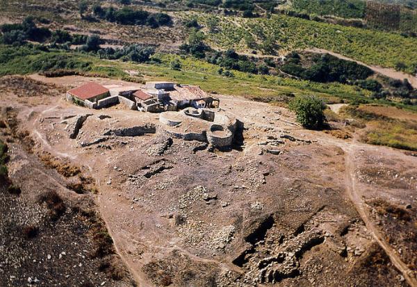
Excavation area (after Santos et al. 2009)

Location: Évora municipality, Évora district, Alentejo, South Portugal)
Chronology: Chalcolithic
Bibliographic references: (Santos et al. 2009)

Horta do Albardão 3 is a recently detected enclosure defined by, at least, one ditch.
The ditch is 2,2 meters wide and 2 meters deep, with a section in a slightly asymmetric “V” with a strait base forming a rectangular segment, similar to ditch 4 of Perdigões. It was excavated by Arqueohoje Lda in the context of rescue Archaeology. As usual in Portugal, the excavation and research done was restricted to the affected area. So, just a very small section of the ditch was excavated and no further work was required to determine or infer the size or shape of the enclosure. Nevertheless, the segment excavated seems to indicate a sinuous smoothly wavy ditch, like the one of Perdigões and others.

The ditch was dated from the second half of the 3rd millennium BC (Middle/Late Chalcolithic). Next to the ditch, a funerary pit with a human inhumation was dated from the Bronze Age.

In Iberia, the building of ditched enclosures seems to have stopped during the Chalcolitic, precisely during the second half of the 3rd millennium BC. Nevertheless, some evidences are slowly starting to appear, showing the presence of materials or specific contexts of Bronze Age in some of these sites. The same is happening in Perdigões and in Outeiro Alto 2. Except for the later, data is quite scarce yet to allow any consistent interpretation of those presences. But it is gradually becoming clear that at least some ditched enclosures, deactivated and “abandoned”, still mark the landscapes and the social memory with significant capacity of attracting the Bronze Age communities, namely to burying their death.

I called this circumstance a symbolic extend (Valera, 2003) that makes a site socially active after the abandonment related to its original context of function and meaning. A memory is not simply a passive bank of data, but one of the most active “tools” that frames human action. And sites like enclosures, ditched or walled, have the potential to be what the cognitive sciences call external memory and develop powerful means of attraction. I will be back to this issue.

References:
Valera, António Carlos, (2003), "O abandono de povoados fortificados calcolíticos no Ocidente Peninsular", ERA Arqueologia, 5, Lisboa, Colibri/ERA Arqueologia S.A., p.126-148

Friday, June 17, 2011

0032 - Making them visible

Helmut Becker at Moreiros 2.

In the archaeoastronomy of enclosures project in course, we have been using geophysical prospection to obtain the complete (or almost complete) plans of enclosures. Helmut Becker is the responsible for that survey. He is using Caesium-magnetometry.

To do his ultra-high sensitive cs-magnetometry, he is using Geometrics cs-magnetometer G-858G in the so-called duo-sensor configuration for total field measurements. The sensitivity of the magnetometer is 20 Picotesla (0.02 nT). The spacing of the 2 sensors was set to 0.5 m – with the measuring cycle of 10 Hz (10 measurements per second) the resolution was 50 x 10 cm (50 cm distance of the profiles in the 40m-grids and 10 cm samples on the profile). This is the fastest and most sensitive method for archaeological prospecting on large areas. Almost one hectare per day could be measured with this high resolution. Measuring the geomagnetic total field rather than only the gradient of the vertical component with fluxgate-gradiometry allows a much deeper penetration into the ground (major archaeological structures can be made visible to a depth of 4 to 5 meter).

Preliminary data processing is done every night directly after the fieldwork – therefore any new ideas about the continuation of the prospecting could be immediately realized.

The results have been quite remarkable, as we can see by the examples of Xancra, Perdigões or Moreiros 2.

Next week we will be starting Monte do Olival 1 and expectations are high.

Thursday, June 16, 2011

0031 - Models and enclosures (1)

Walled enclosure of Zambujal (image from here). One of the classic sites in the debate of walled enclosures in Portugal.

During the seventies of the XX century, Carlos Tavares da Silva and Joaquina Soares undertook an approach that was based on localism and on a materialistic theoretical background. The emergence of Chalcolithic societies in South Portugal was seen as the consequence of labor development and production intensification, framed by a Secondary Product Revolution dynamic. This social-economic development would support segmented political structures, characterized by autonomic communities, basically equalitarian, organized at a local scale. Localism was seen as a reinforcement of social relations based on sedentary residence and in territorial contraction, generating a social, economic and political autonomous environment, according to the model of “one site / one fortification / one territory / one community”. Autarchy and competition for strategic resources would have generated a condition of “global war”, responsible for the fortification of settlements present for the first time in the archaeological record. War would export conflict and tension to inter-community relationships and preserve the internal unit of the group on an equalitarian basis. Finally, equalitarianism and political autarchy were seen as reaction to a centralist and hierarchic process, allegedly emerging in the late Neolithic. This was the theoretical background to explain the Chalcolithic walled enclosures.

Theoretical disputes apart, this model suffered from problems of scale and data. At the time, few Neolithic and Chalcolithic enclosures were known and fewer were excavated in Alentejo. It was pioneering times. Discourse was built on a reduced number of isolated sites, scarcely excavated in the majority, and quite distant from each other, extracted from their unknown settlement networks context and landscapes. A more realistic density and diversity of territorial occupation was yet to be disclosed, and the situation was propitious to localism and to interpretation centered on the site regardless its context: the site was the scale of analysis and then, by a generalization process, discourse was extending to a regional scale (Southwest Iberia). A uniform pattern of chacolithic settlements location was establish: high places, with good visual control of landscape and fine natural defense conditions.

Naturally, today this picture is no longer empirically sustainable and is also questionable theoretically. But, at the time, it was the first attempt to introduce historical materialism in the Portuguese Recent Prehistory. And, in the context of an Archaeology dominated by Cultural Historical perspectives, based on diffusion as the major mechanism to explain social change, that regarded the walled enclosures (first) as colonies and (after) as trading posts, this materialistic approach became quite refreshing at theoretical level in those days.

References:
Silva, C.T. e Soares, J. (1976-77), "Contribuição para o conhecimento dos povoados calcolíticos do Baixo Alentejo e Algarve", Setúbal Arqueológica, II-III, Setúbal, MAEDS, p.179-272.
Valera, A.C. 2009, “Cosmological bonds and settlement aggregation processes during Late Neolithic and Copper Age in South Portugal.”, Thurston, Tina L. and Salisbury, Roderick B.(eds). 2009. Reimagining Regional Analyses: The Archaeology of Spatial and Social. Dynamics. Newcastle: Cambridge Scholars Publishing.

Wednesday, June 15, 2011

0030 - A long way from home

Some of the imported objects and raw materials at Perdigões enclosure: “green stone” beads; recipients and idols in limestone; gold; long blades of flint; objects in ivory.

One thing in common to the large ditched enclosures, but that seems to be less significant or totally absent in the smaller ones, is the present of a lot of exogenous raw materials and artefacts. In some cases, the local of origin can be traced back to far away regions.

At Perdigões set of enclosures, and in Chalcolithic times, we have elements coming from several regions of Spain, others from Portuguese Estremadura or Alentejo´s coast and even from North Africa, like the ivory from bush elephant.

This kind of objects are absent or extremely rare in the surrounding settlements, enclosed or not, revealing that the site locally catalyzed the relations with the outside. Those relations were probably not direct, especially with the far regions, but intermediated by others. Large enclosures, then, seem to play a leading role in inter regional interaction.

In fact, several archaeometric studies (of pottery, beads, metal, ivory) in course at Perdigões are being used to built an image of those interactions, identifying potential origin places and suggesting relations whit other large enclosures, like Pijotilla and San Blás, also in the Middle Guadiana basin, but in Spain.

But because things don´t move along by themselves and because of the fact that all of those large ditched enclosures were also places where funerary practices were intensively present, we are now starting to look into the human remains (through DNA and other methods, such as teeth morphology) hopping to go further in mapping those relations.

How to value this in terms of social organization? Well, we have a couple of models available in the theoretical market. But that is food for future posts.

Tuesday, June 14, 2011

0029 - Porto Torrão ditched enclosure

Late Neolithic ditch (left) and Chalcolithic ditch (right)

Location: Ferreira do Alentejo municipality, Beja district, Alentejo, South Portugal)
Chronology: Late Neolithic and Chalcolithic
Bibliographic references: (Arnaud, 1993; Valera & Filipe, 2004; Valera, 2010; Valera et.al. in press)

Porto Torrão is known as a large Chalcolithic site since the eighties of the last century (Arnaud, 1983), but only in 2002 it became clear it corresponded to a complex set of ditched enclosures.

The excavations that detected the presence of ditches for the first time were conducted in a context of emergency Archaeology (Valera & Filipe, 2004), related to the building of a high voltage electricity line. The excavation of the area of one of the pillars of the line revealed two parallel ditches, separated only by eight meters (a space where some pits were also identified and excavated).

Although the ditches were close to each other, they were from different chronologies. The inner one was filled almost to the top by sediments with Late Neolithic materials and the outer one with materials from Chalcolithic, with the presence of Bell Beaker almost from the beginning of sedimentation.

The Late Neolithic ditch is 3,5 meters wide and 3 meters deep and the Chalcolithic one 5,9 meters wide and 3,4 meters deep. In the first one, some pits were identified inside the ditch, opened along the filling sediments.

More recently, again in a context of emergency Archaeology, other ditches were identified, and several necropolis of tholoi and hypogea were detected around the enclosures (Valera, 2010; Valera et al., in press). The limits and the design of the enclosures and necropolis are not yet known, but the general image points to a large complex and one of the biggest of Iberia.

Peripheral necropolis of tholoi and hypogea (a particular structure is a ditch function as an atrium of access to several the funerary chambers through passages excavated in the ditch wall. Inside the ditch, several pavements of circulation were identified). (Image published in Valera, in press,in, Michael Kunst, Roland Gauβ, Martin Bartelheim eds., Vom Erz zum Kupferartefakt. Metallurgie des 3. Jahrtausends in Zambujal und im Südwesten der Iberischen Halbinsel, DAI, Madrid.)

Monday, June 13, 2011

0028 - Walls, walls and walls

Walled enclosure of Monte do Tosco, with walls less than a meter thick (left); walled enclosure of Fraga da Pena, with walls 3 meters thick (right).

In English there are “walls”, “walls” and “walls”. In Portuguese there are “muros”, “paredes” and “muralhas”. “Muros” are short and thin walls; “paredes” are high and thin walls; “muralhas” are high and thick walls. So, whatever is the structure, in English there is no big problem with the designation walled enclosure. But in Portuguese the generalized expression is “fortified settlement” (and the structures usually designated by “muralhas”) and that raises problems.

The main problem is that the expressions “fortified settlement” and “muralhas”, on the contrary of walled enclosure, are not “neutral”: they already imply a specific intention and functionality related to defence in a context of human vs human violence. And the expressions have been traditionally used without careful, regardless available data... and theory.

In fact, and regardless everything else related to context, a wall 0,80cm thick (a “muro” or “parede”) is quite different, in a lot of aspects (labour involved, available raw material, sustainability, resistance, visual impact, meaning, function, etc.) from a wall 2,5 or 3 meters thick (a “muralha”). Just like a ditch of 1,5 meter wide and a meter deep is quite different from a ditch 10 meters wide and 5 or 6 meters deep.

So, if we want to designate this general type of enclosures, it would be better to do it with a designation not compromised with specific functions and meanings. Easyer to do it in English than in Portuguese. It is an example of the difficulties generated by the available vocabulary of a language. And we all know how language is structural to our rationalization of the world and to our knowledge production. People tend to forget that, sometimes, a name is a synthesis, an arriving point and not a starting one (or that they must run the race before reaching the goal).

Saturday, June 11, 2011

0027 - Drying the enclosures


Lots of things can happen inside a ditch, like discussions between archaeologists, for instance.

The data coming out of ditches, when conveniently published, ravels that many actions took place inside, some of natural origin, most of human initiative. Along the filling layers we can detect organized depositions, pits dug in previous layers, stone structures, human burials, etc. In Portuguese enclosures, we can observe this in several sites where excavations are larger than a small section: Perdigões, Santa Vitória, Porto Torrão are some examples.

Structured deposition inside ditch 3 of Perdigões.

This is not very consistence with the idea that those ditches were built to be water canals or drains, a justification that continues to be too easily adopted in some discourses. And another inconsistence is the topography (which I already classified as very important in enclosures interpretation). Most of those enclosures are in slopes, with significant differences of altitude between the several sections of the ditches. Because of the water levelling, this topographical situation implied that water would concentrate in lower sections, living large parts of the ditches dry when the water was less, overflowing the ditches when the water was too much.

But of course water run inside ditches in rainy days. That is inherent. And when it rained hard, erosion took place, just like ditch 3 of Perdigões shows at middle depth. This could be an argument for the drainage theory. But in sites with the topography of Perdigões, an amphitheatre, the water would run rapidly to East and concentrate in the upper side of the entrances that interrupt the ditch, generating a pull and overflow the entrance. At Xancra and Monte do Olival, located in slops orientated to East and with their entrances also in the eastern parts of the enclosure, this would mean a permanent flooding of the doors and of the low parts of the enclosures. This would be very inconvenient and, mostly, would have left evidences in the strata sequence that was not yet recorded in the excavated sites.

A drain should not be interrupted and should be proportional to the draining needs. So why built drains of 7 meters wide and 3,5 meters deep? That’s a canal of the Industrial Revolution. Why built wavy drains of 2,5 meters wide and 1,5 deep to drain an area of 20m diameter at Santa Vitória or Outeiro Alto 2?

For all those reasons, water canals and reservoirs or draining structures are not very consistent primary functions to explain the building of the most part of ditched enclosures. Water flows inside them. But as intrinsic circumstance that comes along with this kind of structures. Not as an intended one for the building decision. And if there are exceptions, they must be empirically demonstrated by evidence from strata sequences inside ditches and by topography consistence and not simply assumed.

Reconstruction of the set of enclosures of Los Marroquiés Bajos (Jaén, Spain), assuming the ditches as water canals

Thursday, June 9, 2011

0026 - Going public on large enclosures

It is not from Portugal (is from Jaén, Spain), but reveals one of the views develop for the Iberian large enclosures (called “macro villages”). This kind of interpretation is also assumed for Alcalar, Porto Torrão or Perdigões by some theoretical backgrounds, namely based on functionalism and historical materialism. In the last years, strong criticism has been developed, but it has not been ease to promote debate. Maybe is because of that the different approaches and the different discourses are rarely presented to the public and monolithic interpretation prevails.

0025 - Dogs, depositions and ditched enclosures

Dog skulls in Ditch 3 of Perdigões

Dog skulls in ditch 3 of Perdigões. This situation drives us to the classic problem of “is it ritual or rubbish? (Question asked by Hill, 1996). The question is, in fact, a version of the much larger problem of identifying and interpreting human intention in Archaeology (especially Prehistoric). The debate developed a concept, structured depositions, which have been used to fulfill the semantic emptiness that emerged with the criticism to the use of the modern notion of rubbish (a meaningless discard with no value and no importance).

The criticism lays in the perception that what is unsacred today and understood as waste and without value, could, in different social contexts, correspond to meaningful and symbolic actions. Therefore, we would be in presence of “structured depositions” and not chaotic and unorganized rubbish.

So, “structured depositions” emerge as a designation that “saves us” from precipitated projection of social practices anchored in modern systems of references, allowing the emergence of different intentions and different contextual social meanings.

Nevertheless, as Olsen (2000) puts it, the designation in itself doesn’t offer any explanations or interpretations regarding the nature of the depositions. Therefore, context and pattern play a decisive role in defining that nature and ultimately in distinguish rubbish from other intentional depositions.

And the context of this ditch in Perdigões is one of horizontal deposition of layers of stones, pottery shards, and faunal remains (but no other dog bones except from the skull parts). They are selected materials that are not representative of the totality of materials that circulate at the site at the time nor of dog skeleton. On the other hand, depositions of dog skulls (or heads) seem to define a practice all over Europe in the period. In Iberia, the case of Camino de las Yeseras (Liesau et al. 2008) is a reference: a ditch enclosure where in a pit several dog heads were deposited in a organized way after being cut off. In a lot of other places, the presence of dog remains corresponds only to parts of the skull (inclusively in Perdigões ditches 3 and 4): San Juan Ante Portam Latinam, Mas d’en Bixos, Pou Nou 2 and 3, Marroquiés Bajos, Picarcho, Quinta do Anjo or Alcalar 7.

And when is not the skull, are the paws in anatomical connection. In fact, the problem of structured depositions is quite linked to another one, and both should be address in the context of the same mental framework: the problem of body segmentation, shared by animal and human treatment of remains. Segmentation and valorisation of parts seems to have played an important role in the social fabrics of those societies. In fact, we are talking about segmentary societies. Segmentation is strategic and structural (Valera, 2010b). And ditch enclosures are a major context to address this problem.

(in Valera, 2010a, adapted)

References:

HILL, James D. (1996), “The identification of ritual deposits of animals: a general perspective froam a specific study of ‘special animal deposits’ from the Southern English Iron Age”, (S.Anderson e K. Boyle, Eds.) Ritual treatment of human and animal remains, Oxford, Oxbow Books, p.17-32.
HILL, James D. (2000), "Can we recognise a different european past? A constrastive archaeology of Later Prehistoric Settlements in Southern England", Interprettive Archaeology. A reader., (J. Thomas ed.), London, Leicester University Press, p.431-444.
LIESAU, C., BLASCO, C., RIOS, P., VEGA, J., MENDUIÑA, R., FRANCISCO BLASCO, J., BAENA, J., HERRERA, T., PETRI, A. e GÓMEZ, J. L. (2008), "Un espacio compartido por vivos y muertos: el poblado calcolítico de fosos de Camino de las Yeseras (San Fernando de Henares, Madrid)", Complutum, 19(1), Madrid, p:97-120.
OLSEN, Sandra L. (2000), "The secular and sacred roles of dogs at Botai, North Kazakhstan", (Crockford, S. ed.), Dogs through time: an archaeological perspective, Bar International Series, Oxford, p.71-92.
VALERA, A.C., NUNES, T. & Costa, C. (2010a), “Enterramentos de canídeos no Neolítico: a Fossa 5 de Corça 1 (Brinches, Serpa)”, Apontamentos de Arqueologia e Património, 5, Lisboa, Nia-Era, p.7-17.
VALERA, António Carlos (2010b), "Marfim no recinto calcolítico dos Perdigões (1): "Lúnukas, fragmentação e ontologia dos artefactos", Apontamentos de Arqueologia e Património, 5, Lisboa, NIA-ERA Arqueologia, p. 31-42.

Wednesday, June 8, 2011

0024 - Monte da Ponte walled and ditched enclosures

Geophysical image and topographical profile of Monte da Ponte (after Kalb & Hock, 1997)

Location: Évora municipality, Évora district, Alentejo, South Portugal)
Chronology: Chalcolithic
Bibliographic references: Kalb & Hock, 1997.

Monte da Ponte is one of the two chalcolithic enclosures known in Portugal that combine walled and ditched enclosures (the other is Salgada). This can be observed in the geophysical prospection image (obtained by Helmut Becker). In a small hill there are a set of several walled enclosures, some of them with bastions. In the beginning of the plain, a double circular ditched enclose the hill and its walls.

This circumstance has been used to argue in favour of a direct relationship between walled and ditched enclosures (an issue I’ll come back latter), but it is premature to assume that connection just based on a geophysical image. Facing the actual chronologies available for ditched enclosures in South Portugal, that go back to Late Neolithic (2nd half of the 4th millennium BC), we cannot assume a priori that ditches and walls are contemporaneous at Monte da Ponte. Furthermore, several occupations of a same site, separated by abandonment phases, don´t imply continuity of function and meaning, as can be seen and argued for quite a few other sites.

So, just like a lot of other complex and enduring enclosures (like Perdigões, for instance), we must put temporality in the different structures and establish their context before assume certain conclusions.

Tuesday, June 7, 2011

0023 - Charneca do Fratel walled enclosure


Wall of the enclosure (after Soares, 1988)

Location: Vila Velha de Rodão municipality, Castelo Branco, Beira Interior, Central Portugal)
Chronology: Late Neolithic and Chalcolithic
Bibliographic references: Soares, 1988.

Many Portuguese chalcolithic walled enclosures are known only through small archaeological interventions and several of them were never conveniently published (a traditional problem of Portuguese archaeology). This is the case of Charneca do Fratel, where an excavation was conducted in 1987/88 and published in a short notice.

That note, now easy to obtain in the net, says that, after an occupation of Late Neolithic, a Chalcolithic walled enclosure was built in a restricted sector of the previous area of occupation. The wall is two meters thick and an entrance and circular bastion were identified. It had the base made of stones and the top is thought to be made of clay. A scattered megalithic necropolis around the site is referred and the site is relatively close to one of the greatest Portuguese rock art sanctuaries in open air in the valley of a large river (Tagus, in this case) and contemporaneous of some of the engravings. The enclosure is referred as an example of South Iberia chalcolithic systems of defense.

Charneca do Fratel is at north of the south Portugal hinterland concentration of enclosures, in a region where this kind of sites is rare (for the moment). Its potential is obvious by the short description (of the site and its archaeological context) and its location makes it even more interesting. Nevertheless, research seems to have stopped, maybe because the site was considered just another fortified settlement like so many others in Lisbon Peninsula or in the Southwest and Southeast Iberia, integrating a repeated general model of social organization. I think further research should be developed, perhaps with an approach that pays particular attention to the local landscape semantics. I suspect that is an entirely new discourse that can be written about this general context.

Monday, June 6, 2011

0022 - Disclosure the enclosures


Report on Xancra´s geophysical survey published on “O Público” (click in the image to enlarge)

Although ditched enclosures are known for a long time in Europe, and in Portugal since the eighties of the XX century, the general Portuguese public ignores this kind of archaeological sites and their scientific and heritage importance. People know or heard of megalithic monuments, but they don´t have any awareness of enclosures, of their relations to megalithism, of the large sizes they may reach, of the complexity they may present, of the fascination they may have on us.
This is a problem at several levels. One of them, is that people don’t understand the need (and the costs) to preserve and study this kind of sites. They were not educated to value them, therefore they don´t value them.

So, it is the responsibility of any research project on the matter to assume its own publicity and to promote the disclosure of the produced knowledge. As someone once said, the goal of scientific knowledge is to become common sense. Only shared it gains its social relevance and be in a position to require for social value and support.

And ditched enclosures can provide us with a lot of important and attractive stories to tell about Prehistory and about ourselves. As they did in the past, they can help bringing people together around heritage value, especially in times of difficulties, where culture tends to be undervalued.

Friday, June 3, 2011

0021 - Digging at Perdigões 1


Next month I’ll be back to Perdigões, continuing the excavations in the central area (the NIA-ERA Arqueologia project and the project on funerary practices supported by FCT, where NIA-ERA has the collaboration of the Anthropology Department of University of Coimbra and the Nuclear Technological Institute).

There, we have the inner ditch from Late Neolithic (with several pits and ovens) and a possible palisade canal. As is clearly seen in the geophysics, in the area of excavation a large circular “structure” slightly cuts the inside part of the ditch. This cutting was done in Chacolithic times, and several deposits and structures are filling that circular “something”. One of those structures is a pit filled with deposits of human cremations done elsewhere. Other structure with burned human bones was detected nearby and will be excavated this year. The sequence ends in the Eastside of the surveyed area, with a large circular stone structure (not yet completely defined), apparently associated to beaker pottery and other pottery shapes that suggest a Late Chalcolitic / Early Bronze Age.

So, in the same small area (of 180m2), we have an interval of occupations of 1000 to 1500 years, with very different uses and structures, revealing how complex is the sites and how cautious we must be in the interpretation of the geophysical image. “Putting time” in those endless structures is one of the most important tasks of the next... shell we say... decades (if we have in mind the almost 20 hectares of site).

Reference:
Valera, António Carlos (2010), "Construção da temporalidade dos Perdigões: contextos neolíticos da área central", Apontamentos de Arqueologia e Património, 5, Lisboa, NIA-ERA Arqueologia, p. 19-26.

Thursday, June 2, 2011

0020 - The importance of Topography


The picture presents the topographical locations of Xancra (at the top) and Monte do Oilval (at the bottom). Both are in the middle of slopes, with high ground behind. Xancra is in a smooth open slope facing east. Monte do Olival is in a more inclined one, with the hill top just in the back of the enclosure, facing northeast. The chosen topographical ground for these two enclosures is quite similar to the one selected to the cromlechs of Almendres or Vale Maria do Meio.

Wednesday, June 1, 2011

0019 - "Wavy ditches"

The number of known ditched enclosures in South Portugal has been increasing in the last years, being almost thirty now. Between them, several present a peculiar design that has been designated by “sinuous ditches”. This peculiar configuration didn’t raise the necessary attention to its interpretation, as a result of a functional attribution that doesn’t question the ideological foundations of architecture.

In a recent paper (Valera, in print 2010) I presented a first attempt to organize these particular designs in four basic categories according to integral or almost integral plans of ditches:


A. Sequences of regular and aggregated lobes (1. Santa Vitória; 2. Outeiro Alto 2; 3. Xancra); B. Sequences of separated regular lobes (4. Moreiros 2; 5. Águas Frias); C. Regular wavy (6. Juromenha 1; 7. Perdigões); D. Irregular wavy (8. Águas Frias; 9. Perdigões).

This morphological diversity is certainly meaningful and the traditional association to the design of walls with bastions, if arguable for some of these categories (such as the B. or even D.), is clearly unacceptable for the A. and C.. Explanations for the particular designs like the ones in Xancra, Santa Vitória or Outeiro Alto, that so far represent a specificity of the middle Portuguese Guadiana basin, need to be searched elsewhere. In the quoted paper I argued that some answers can be found in the ideological connotation of architecture, namely in its cosmological foundation. Locations, topography, astronomic orientation, landscape connections and design, all talk about architectures that are impregnated by cosmologic senses, without which these sites cannot be comprehended.

Reference:
Valera, António Carlos (in print 2010), “Fossos sinuosos na Pré-História Recente do Sul de Portugal: ensaio de análise crítica”, Actas do V Encontro de Arqueologia do SW Peninsular.